info@skybots.in
+91 8754531574
Location
| The complete workflow in under 9 minutes! | 8:08 |
| About us! | 2:19 |
| Welcome! | 0:10 |
| Who is this course for? | 0:40 |
| Topics covered in this course | 1:12 |
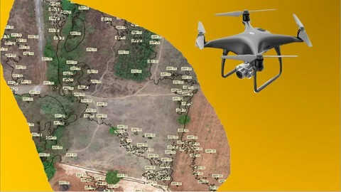
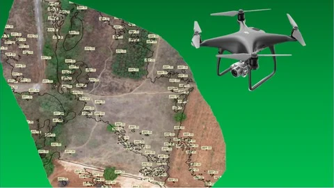
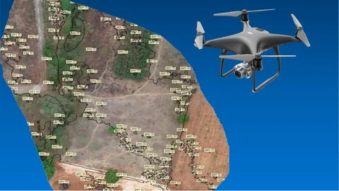
| Definition of GCPs and why they are needed in surveying | 5:24 |
| |
| |
| What are global coordinates? | 2:32 |
| |
| Different ways to capture GCPs | 2:27 |
| GCP best practices (1) | 1:20 |
| |
| GCP best practices (2) | 5:30 |
| |
| GCP best practices (3) | |
| 2:15 |
| Flight planning and GCP positioning strategy | 2:10 |
| |
| On site GCP capture and drone flight execution | 4:31 |
|
| Processing workflow with GCPs (1) | 2:43 |
| Processing workflow with GCPs (2) | 7:54 |
| |
| Processing workflow with GCPs (3) | 2:54 |
| |
| Difference in outputs between GCP and non GCP processing | 3:19 |
| |
| |
| Conclusion | 0:43 |
| Appendix: White paper on GIS based 3d digitization of physical assets | 0:02 |
|
This course is the third part of the 3 course series “The Ultimate Guide for Land Surveying with Drones”. This part covers end to end processes and techniques of using Ground Control Points (GCPs) for Land Surveying with Drones.
To obtain the highest amount of global accuracy in your drone mapping project, the most common and effective method is to use GCPs. We have detailed out all the steps involved in strategizing, capturing and processing drone survey data with GCPs.
This course is especially useful for those of you who have experience with aerial surveying and want to make your outputs absolutely survey grade by incorporating global accuracy.

HUVIAiR Technologies is a Visual Data Technology company. Its major investor is Boeing. Huviair collects, processes and analyses contruction and mining jobsite data using Drones, 360 Cameras, Laser Scanners and Mobile Phones helping you save on progress monitoring time by 75%, manpower requirement by 50% and overall costs of the project by 20%.
We have a deep understanding of UAVs, sensors, photogrammetry, GIS mapping, surveying techniques, image processing, data analytics and software programming.
Our cloud based productivity enhancement software platform provides measurement and reporting of relevant metrics of construction progress tracking by converting data from various sources such as drones, laser scanners and 360 cameras into actionable, measurable metrics.
Vikshut Mundkur and Arjun Janananda are the instructors for our Udemy courses. As the CEO and CTO, respectively, of HUVIAiR Technologies, they have mastered drone mapping and data processing techniques. They have also developed processes and workflows for understanding customer requirements, planning and executing drone flights, processing the data and analyzing the outputs. They have an in depth understanding of photogrammetry, surveying techniques, terrain mapping and using GIS and CAD software


Incorrect OTP
Incorrect OTP
Designed and Developed by B2L Mobitech Pvt. Ltd.
Incorrect OTP
Designed and Developed by B2L Mobitech Pvt. Ltd.